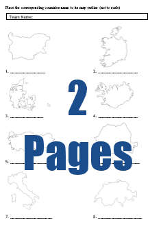
Picture Quiz - European Country Maps
 This picture round contains lots of maps of European countries in a table, split over two pages.
Followed by a page answers on a separate page, included in the same document.
The picture quiz was submitted by Greg Burnes in Dubai. Thanks a lot Greg, a great picture round.
Obviously you only need to print the second page once.
Simply print out the following document and hand out the first two pages to every team.

Picture_Quiz_-_European_Country_Maps.pdf
Game: Teams must identify the European Country from the map outlines shown.
The third page of the document contains the answers.
- Hits: 97454
